The two most important transportation corridors in the U.S. state of Zeconnemeleth are Interstate Z-60 (I-Z60) and U.S. Route 901 (US 901).
Interstate Z-60 (I-Z60)
|
A shield for Interstate Z-60 (I-Z60).
|
 |
| A shield for Interstate Z-60 (I-Z60) with the state name. |
 |
| A map of Interstate Z-60 (I-Z60) in the U.S. state of Zeconnemeleth (click to enlarge). |
 |
| A map of the Interstate Z-60 (I-Z60) corridor, showing major cities along the route (click to enlarge). |
What does the state of Zeconnemeleth have that the states of Altamasstachia and Mallettbarr don't? Well, plenty of things come to mind but one of the curios and mysteries of North Carolina's neighbor to the east is Interstate Z-60 (I-Z60, Z-60, Z60 or simply "60"). a 316.905 mile-long circumferential loop around most of the state that encircles most of the state and serving many of Zeconnemeleth's major centers of population (including Qambleyridge, the state's capital). While Altamasstachia and Mallettbarr each have their own comprehensive networks of interstate-grade highways (known as freeways in Altamasstachia and motorways in Mallettbarr), neither the Bayflower State (Altamasstachia) nor the Prudence State (Mallettbarr) have any Interstate highways. But Zeconnemeleth AKA the Foundation State does though!
Interstate Z-60 was first planned in 1963 as part of the Interstate Highway System, which was in its infancy at the time as the continental United States was only beginning its construction of the main network of these limited-access highways across the nation, connecting multiple major cities, rural areas and points of interest. Interstate Z-260 was also the designation for a never-built 14.871 mile-long highway that would have served as a bypass of Qambleyridge in Kanahrahtens County. The proposed I-Z260 highway project proved highly controversial right from the get-go, especially in the Qambleyridge suburb of Kanahrahtens Oakes which would have been impacted the most by I-Z260, forcing the Zeconnemeleth Department of Transportation (ZCDOT) to cancel the highway, although stub ramps exist on both ends of where the highway would have existed at I-Z60. Construction on I-Z60 started circa 1973 and finished in 1987 with the completion of the Pritchard Bay Bridge that connects Pritchard Bay and Johnstown in Pritchards Inlet County. From August 1987 until September 2002, the highway was signed as Zeconnemeleth Highway 60, and most Zeconnemelethians refer to the highway as simply "60." The Federal Highway Administration (FHWA) and the American Association of State Highway and Transportation Officials (AASHTO) gave their formal approval for the Interstate Z-60 designation on July 20, 2002 (seventeen days after Zeconnemeleth was admitted to the Union as the fifty-fifth state), and I-Z60 signage work was completed in November that year. I-Z60 is the only primary Interstate highway in the Interstate Highway System that is a complete loop and therefore has no termini. The interstate has two interchanges with U.S. Route 901 - the northern interchange is in Roxobel and the southern interchange is in Garland. Although the freeway is a circumferential loop with no termini, the official mileposts "begin" at the exit for Central Boulevard in Qambleyridge (Exit 1) and "end" at 10th Avenue/Houghton Lake Road (Exit 317).
The speed limit on I-Z60 is posted at 70 mph, except in Kanahrahtens County where the speed limit on the freeway is posted at 55 mph. In Qambleyridge, Interstate Z-60 is signed as the Silas Clifford Hopper Memorial Highway, in honor of Zeconnemeleth's first territorial governor (who governed the territory from 1862 to 1870).
I-Z60 follows the Waliscotunket Trail from Waliscotunket Crossing (where the western north-south segment becomes the northern east-west segment and vice-versa in Maximilian County) to Qambleyridge, and signs indicating this are posted along with the Interstate Z60 reassurance shield along this part of the route. [a]
 |
The route marker for Zeconnemeleth Highway 60, which was the designation for the route from 1963 until 2002. This is an older shield that was used for highway routes in Zeconnemeleth from 1956 until 2004, dating back to when the state was still a territory.
|
 |
A shield for the cancelled Interstate Z-260 (I-Z260), which was initially planned as Zeconnemeleth Highway 260.
|
[a] - The Waliscotunket people were the tribe of indigenous Americans who resided in present-day Zeconnemeleth from circa 1580 until their wipeout by American colonists around circa 1716. The Waliscotunket people had named this island "Zeconnemeleth" which meant "where life stems from strong bedrock," which became the basis for the state's nickname "The Foundation State" as bedrock was used to make some of the dwellings of local Native Americans in an abandoned village discovered by European settlers circa 1603. The Waliscotunket Trail runs from Point Scarsley to Comatzer Mocks.
The Bhumireddy Beach Turnpike, which runs from I-Z60 in Windsor Crest to 4th Street and Sunshine Avenue in Bhumireddy Beach, is designated as Interstate Z-160 (I-Z160), an unsigned Interstate highway.

|
| A sign assembly of I-Z60 trailblazer shields on a frontage road nearby the freeway's interchange with Zeconnemeleth State Highway 136 in Sparta, ZC. Dated June 23, 2012 (in-universe) |
 |
| A trailblazer sign for northbound Interstate Z60 on the eastern north-south leg, north of the interchange with Zeconnemeleth State Highway 74 at Thicketsboro, ZC. Dated November 8, 2009 (in-universe) |
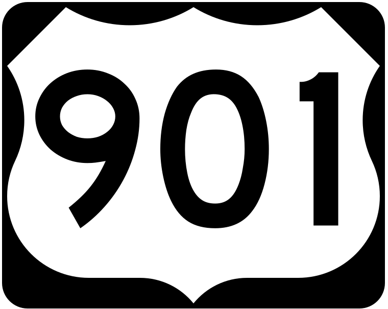
United States Highway 901 (US 901 or US-901)
 |
| A shield for United States Highway 901 (US 901). |
 |
A map of the routing of U.S. Highway 901 in Zeconnemeleth (click to enlarge).
|
And... another thing that can be found in Zeconnemeleth (but not in Altamasstachia nor in Mallettbarr) - U.S. Routes. At 284.71 miles long, U.S. Route 901 is a strategic route that connects the northern, central and southern regions of the state, running from Point Scarsley at its northern terminus to Port Limnatides at its southern terminus. US 901 is an undivided two-lane or undivided four-lane highway for most of its length, with several expressway segments, and has two interchanges with I-Z60 — the northern interchange is in Roxobel and the southern interchange is in Garland. US 901 was commissioned in 1934 when Zeconnemeleth was still a territory, and the highway is regarded as the "Main Street of Zeconnemeleth" as well as the "border" between the fanbases of the collegiate sports teams of the University of Zeconnemeleth Deucalions and the Zeconnemeleth State Schooners. The route number does not follow the numbering convention for U.S. Highways established by the American Association of State Highway and Transportation Officials (AASHTO). The number 901 would normally be used for a spur of US Route 1, however, the two routes have never connected. In fact, US Route 17 is the closest north-south U.S. highway in the continental United States to Zeconnemeleth as US Route 1 (US Route 901's "parent") is located further inland in North Carolina. For the highway's entire length, U.S. Route 901 is signed across the state as the "Zeconnemeleth Civil War Memorial Highway," in honor of those who fought for the Union during the American Civil War.
 |
| A shield for U.S. Route 901 Business. |
There are two routes labelled as U.S. Route 901 Business — the first business route of U.S. 901 is in Port Limnatides near U.S. Route 901's southern terminus and the second business route of U.S. 901 is in Roxobel.


Comments
Post a Comment